TechnologIes
MAPPEM

This system is designed for geology imaging as well as for buried object detection...

TechnologIes
MAPPEM-S

This system is suitable to image the subsurface geology as well as to detect buried objects...

TechnologIes
MAPPEM-3D

This system is adapted to detect all buried objects within a 5 m swath...

TechnologIes
PASSEM

This system is suitable for mobile measurements of the ambient electromagnetic fields...

TechnologIes
STATEM

This system is adapted to realize fixed and precise measurements of the ambient electromagnetic fields...

THE MAPPEM TechnologIes

MAPPEM ELECTROMAGNETIC ACQUISITION SYSTEM

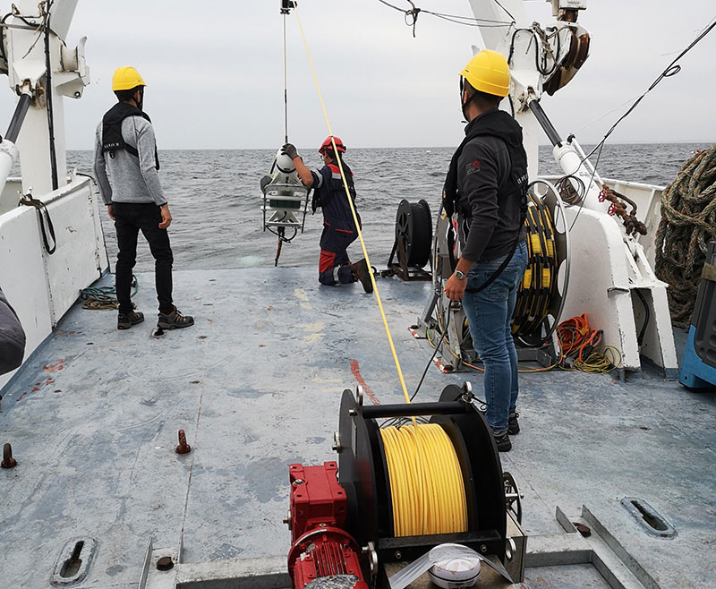
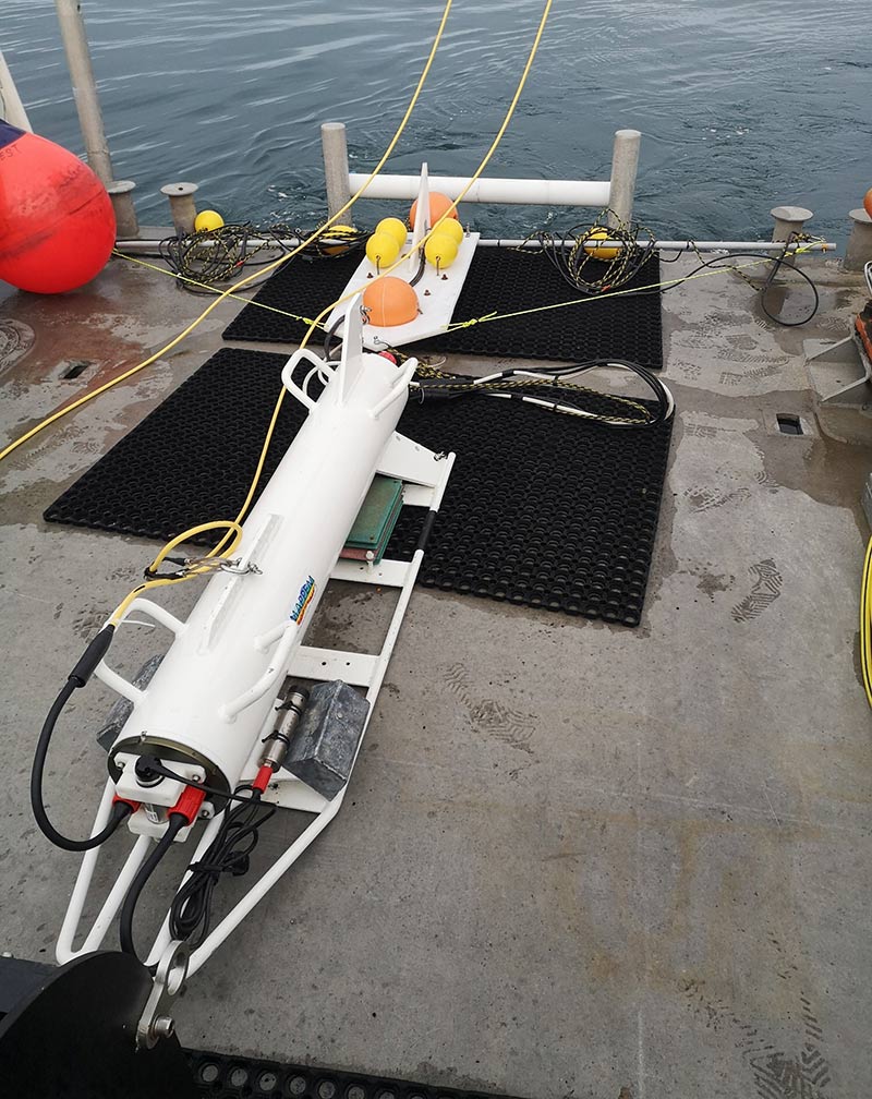
The MAPPEM system is a towed marine resistivity imaging system. It is towed near the seafloor at a speed of about 3-4 knots to record the electrical resistivity of the substratum.


The whole device includes a main tow fish containing the acquisition and control electronics, a secondary tow fish with a current injection electrode, and a cable equipped with potential difference sensors. Data is transmitted in real time to the crew on board. The recorded data includes potential differences, converted into apparent resistivity and then inverted into the true resistivity model of the subsoil.

Advantages

  • Unique fully Marine Resistivity system on the market.
  • Easy to deploy (two people needed, small survey boat)
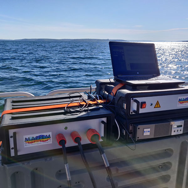
  • Real-time control of the acquisition through the software interface
  • Fast data processing (FASTINV processing algorithm and proprietary methods)
  • Images all types of geologies (including very hard rocks, gas bearing sediments).

Technical characteristics

  • Current injection every 0.5 second
  • Current of about 40 A (up to 100A)
  • Low voltage, non-invasive system
  • Receiving cable with 20 high-precision electrodes
  • Towfish dimensions: 1.5 m long, 20 cm in diameter
  • System towed a few meters above the seabottom
  • Total length of the set-up depending on survey set-up. Up to 120 m for deeper penetration
  • Distance between the receiving electrodes: between 1 and 5 m depending on the penetration objectives.
  • Depth of investigation: depends on the dimensions of the device and the power of the injected current and varies between 10 and 40 m
  • Accuracy of measured potential difference data: a few µV
  • Conversion into resistivity using an inversion algorithm

THE MAPPEM-S Technologies

MAPPEM-S ELECTROMAGNETIC ACQUISITION SYSTEM

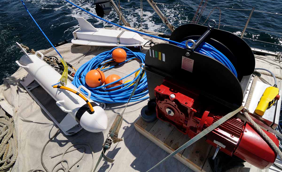
The MAPPEM-S system is a towed marine resistivity imaging system at a speed of about 3-4 knots to record the electrical resistivity of the substratum. It is deployed in very shallow waters.

It has the same capabilities and precision than the original MAPPEM system but in a lighter packaging and implementation, to be used with small draft vessels.

Advantages

  • Suitable for very shallow water surveys (about 0 to 10 m water depth)
  • Easy to deploy 
  • Real time control of the acquisition through the software interface
  • Fast data processing (first models a few hours after acquisition)
  • Images all types of geologies (including very hard rocks, gas bearing sediments)

Technical characteristics

  • Current injection every 0.5 second
  • Current of about 40 A
  • Low voltage, non-invasive system
  • Receiving cable with 20 measuring electrodes
  • System towed at the surface
  • Distance between the receiving electrodes: between 1 and 5 m depending on the penetration objectives
  • Depth of investigation: depends on both the dimensions of the device and the injected current; it varies between 10 and 40 m
  • Accuracy of measured potential difference data: a few µV
  • Conversion into resistivity using an inversion algorithm

THE MAPPEM-3D Technologies

MAPPEM-3D ELECTROMAGNETIC ACQUISITION SYSTEM

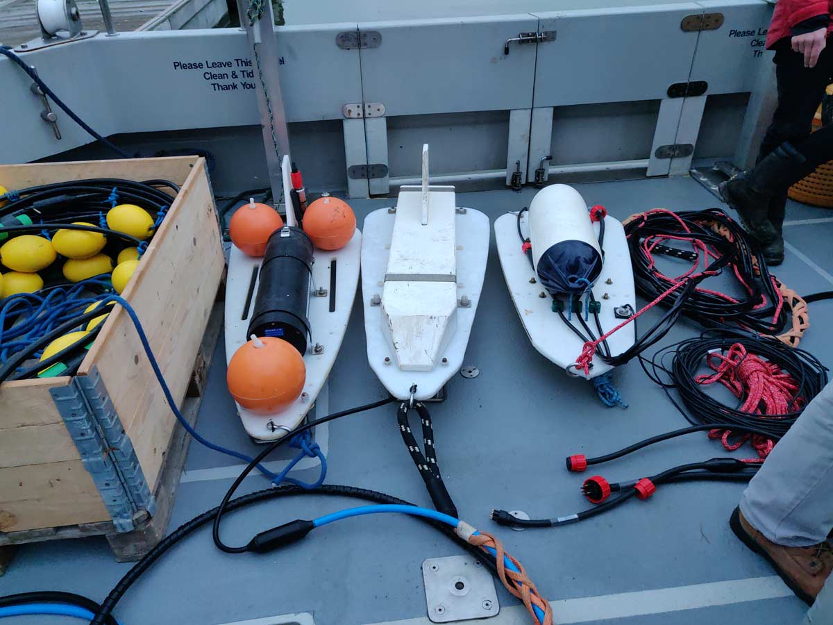
The MAPPEM-3D system is an electromagnetic object detection and localization system towed by a ship near the seabottom at a speed of about 3-4 knots. This system is dedicated to object detection, from UXOs, cables pipelines, archeology, etc.


The whole device includes a main tow fish containing the acquisition and control electronics, a secondary tow fish with a current injection electrode, and a sensor array equipped with potential difference sensors. Data is transmitted in real time to the crew on board. The recorded data are processed in real time with a simplified proprietary algorithm (“BODIES-RT”).

Advantages

  • Unique direction detection of all ferrous and non-ferrous objects (including aluminum LMB mines…)
  • Efficient in all water depth, even in noisy, magnetically perturbed areas.
  • High discrimination of targets
  • Easy to deploy (two people needed, small survey boat)
  • Real-time control of the acquisition through the software interface
  • Fast data processing (automatic detection of anomalies in recorded data using a built-in algorithm)

Technical characteristics

  • Width: 3 m; swath: ~5 m (depending on object and depth objectives)
  • Current injection every 0.3 seconds: High lateral detection and discrimination
  • Electrical current of about 60 A
  • Low voltages non-invasive system
  • Unique sensor array
  • Main tow fish dimensions: 1.5 m long, 20 cm diameter
  • System towed a few meters above the seafloor.
  • Detection of UXOs up to several meters of burial (depends on size of the target)
  • Accuracy of measured potential difference data: a few µV: high sensitivity.
  • Specific “BODIES” processing workflow to highlight detected objects

THE PASSEM Technologies

ELECTROMAGNETIC ACQUISITION SYSTEM PASSeM

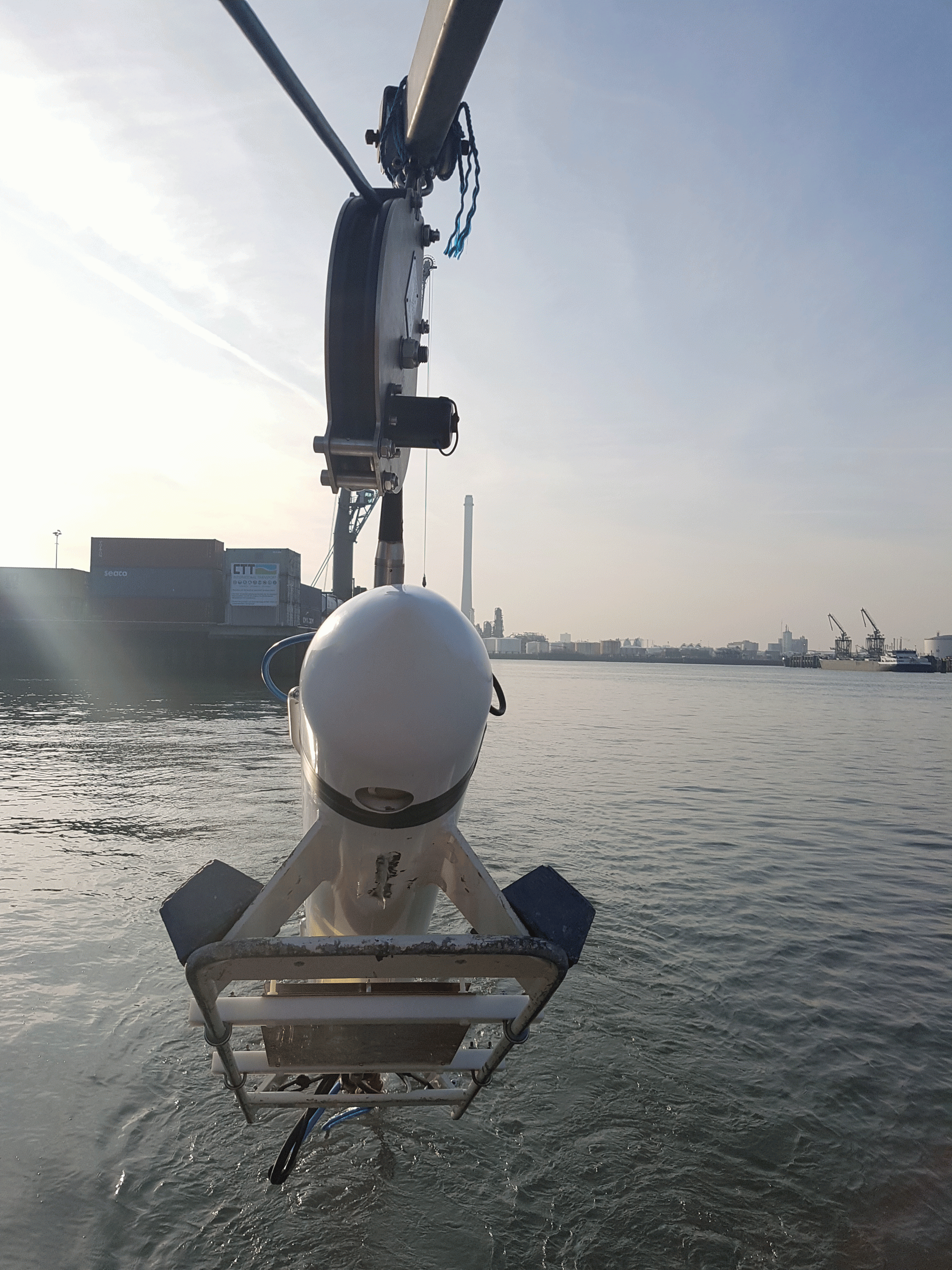
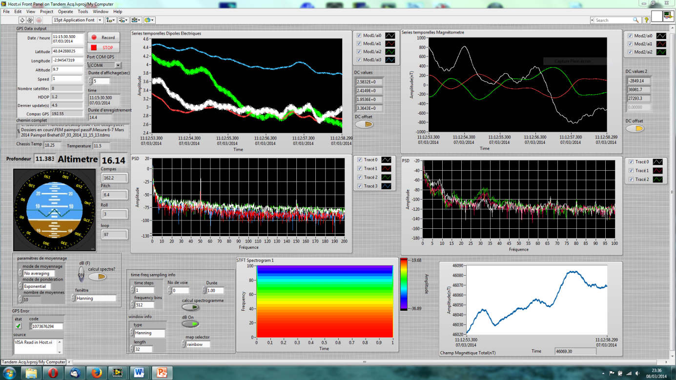
The PASSEM system is a unique system for the measurement of the marine ambient electromagnetic fields in the marine environment. It is towed by a ship  at a speed of about 3-4 knots. The system includes high precision 3 axis magnetic sensor and electric dipoles to precisely measure the local electric fields. Data is transferred in real-time onboard the vessel. 

Advantages

  • High precision magnetic and electric sensors
  • Easy to deploy (two people needed, small survey boat)
  • Real-time control of the acquisition through the software interface
  • Fast coverage of the area
  • Used to assess the environmental impact of marine infrastructures.

Technical characteristics

  • Four independent electric dipoles (E1 to E4), two lengths (typically 4 and 20 m)
  • 3-axis magnetometer
  • DC1 kHz bandwidth
  • 24 bit resolution, high gain
  • Attitude and navigation sensors.
  • Real time data display

THE STATEM technologies

electromagnetic Acquisition System STATEM

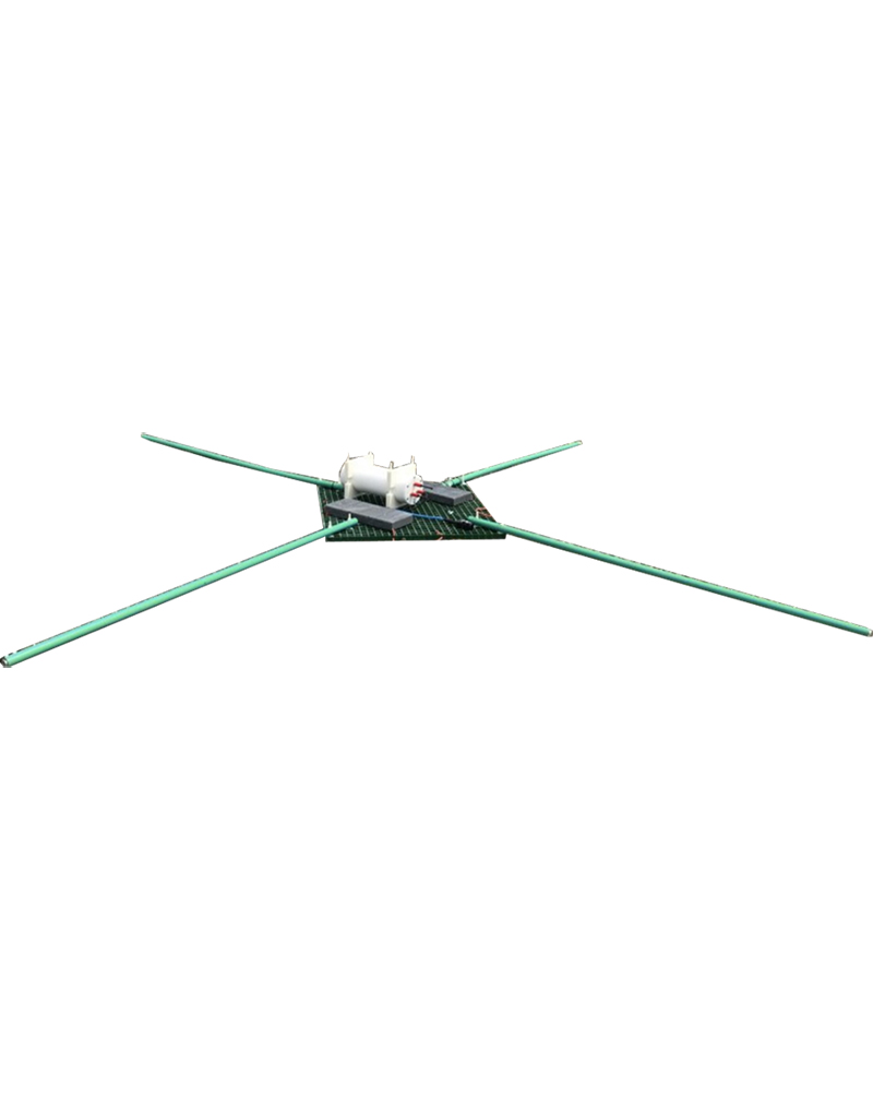
The STATEM system is an autonomous seafloor electromagnetic measurement station. This instrument is used to evaluate the electromagnetic noise generated by anthropogenic infrastructures and during marine magnetotelluric studies in coastal areas.

With a small size, the STATEM is equipped with state-of-the-art 3-axis fluxgate magnetic sensor and two perpendicular electric dipoles. This instrument records 5 components of the electromagnetic fields at 512 Hz for up to about 1 month.

Advantages

  • State-of-the-art performance, long autonomy
  • Easy to deploy
  • Suitable for studies of marine electromagnetic field measurements and detection and Marine magnetotellurics

Technical characteristics

  • 1.0 m x 1.0 m platform
  • Four removable arms of 2 m length (adjustable)
  • Weight of about 25 kg
  • 3-axis fluxgate sensor
  • Two perpendicular electric dipoles
  • Synchronous recording of 5 electromagnetic components
  • GPS synchronization, low drift precision clock
  • 512Hz sample rate, 32 Bits